We detect what's under your ground
Book a FREE consultation with us
What You Need To Know About Our Company
Our company was founded in 2024 by 2 enthusiast archaeologists and it specialises in detecting underground magnetic anomalies which can include burried structures and infrastructure elements. Our goal is to map underground features and to give precise location and orientation of what lays beneath our feet. We aim to give our clients clear datasets and interpretation of geomagnetic surveys of the sites.
What Services We Offer For You
Magnetometry Surveys
High-resolution magnetometry using multi sensor-systems.
Detect burried features without excavatiion.
✔ Rapid acquisition
✔High-contrast results
Magnetogram Processing & Visualisation
High-resolution processing of gradiometer data for archaeological interpretation and documentation.
Data Interpretation
Expert analysis and clear visual interpretations of geophysical results.
✔ Feature outlines
✔ Anomaly-classification
Drone Photogrametry & Aerial Imagery
We capture high-resolution aerial data using professional drones for orthophotos, 3D models and site monitoring.
✔ Ortophotoplan & DEMs
✔ 3D reconstruction
GIS ^ Spatial Analysis
We build layered geospatial maps using LiDAR, aerial photos and survey data
✔ Accurate site modeling
✔ Coordinate integration
✔ Clean, layered outputs
Archaeological Site Assesment
We deliver georeferenced datasets compatible with QGIS, ArcGIS, AutoCAD and Global Mapper.
✔ Geo-referenced overlays for magnetograms
✔ Integration with existing archaeological maps and site plans
The Business Consulting Process
Phasellus dignissim pellentesque mollis, mauris orci dignissim gravida.
Nunc enim quis nibh maecenas convallis eros a ante dignissim, vitae elementum metus facilisis.
Praesent libero augue, ornare eget quam maecenas convallis eros a ante dignissim, vitae elementum metus.
Latest News

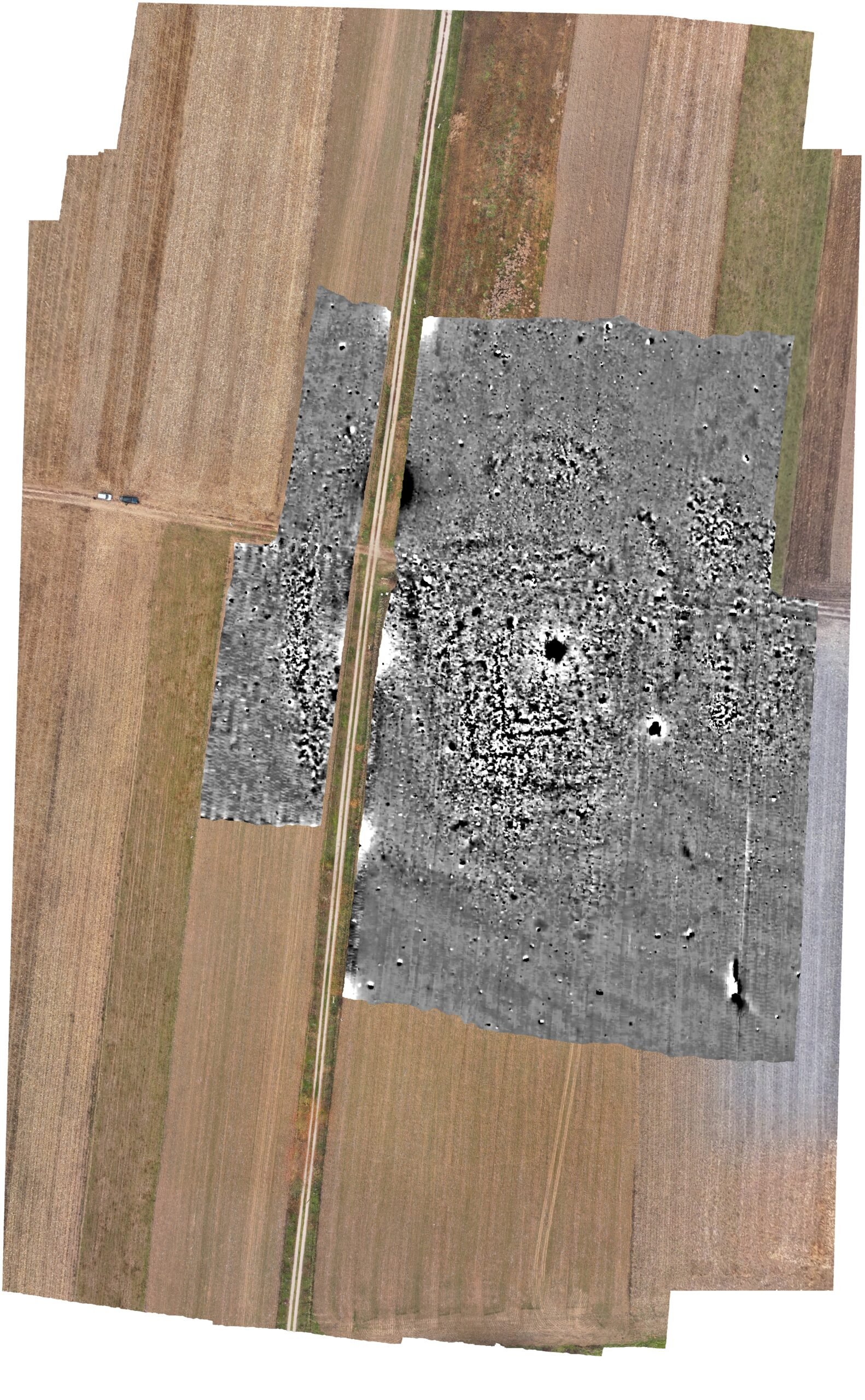
Tehnici de teledetecție și cercetări de suprafață. Contribuții noi la cunoașterea așezărilor din zona Olari, județul Arad
Field survey is a non-invasive approach which helps us document archaeological settlements by observing…
Have a project in mind?
Book a discovery call with us, no commitment, just talking.